UN
69 Bowes Road
£ 200,000
Description
We don't have a Description for this property.
- Bedrooms
- 0
- Bathrooms
- 0
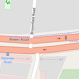


Leaflet © OpenStreetMap contributors
The heatmap indicates the level of crime in the area. The color of the heatmap indicates the crime severity and recency.
Metrics Year-on-Year
- Average area value
- 590,904.00 £Increased by 11.47 %
- Average area rental value
- 1,579.00 £/moDecreased by 19.93 %
- Est rental Yield
- 3.21 %Decreased by 28.03 %
- Crime Rate
- 7.00 %Unchanged by 0.00 %
from 530,125.00 £
from 1,972.00 £/mo
from 4.46 %
from 7.00 %
Nearby Schools
| Name | Type | Ofsted | Distance |
|---|---|---|---|
| The Tab Children'S Centre | Children's Centre Linked Site | 0.48 KM | |
| Bowes Children'S Centre | Children's Centre Linked Site | 0.87 KM | |
| Bowes Primary School | Academy Converter | 0.87 KM | |
| Broomfield School | Foundation School | Good | 0.88 KM |
| Bounds Green Children'S Centre | Children's Centre | 0.95 KM |
Images
Nearby Streets
| Name | Average Price | Average Sqft | Distance |
|---|---|---|---|
| Broomfield Road | £ 160,000 | 0 | 0.00 KM |
| Broomfield Avenue | £ 1,150,000 | 0 | 0.00 KM |
| Eleanor Road | £ 634,000 | 0 | 0.00 KM |
| Pottery Gate | £ 474,000 | 0 | 0.00 KM |
| Bridge Drive | £ 0 | 0 | 0.00 KM |
Nearby Transport
| Name | NLC | TLC | Distance |
|---|---|---|---|
| Bowes Park | 6027 | BOP | 0.65 KM |
| Palmers Green | 6021 | PAL | 1.07 KM |
| Alexandra Palace | 6025 | AAP | 1.61 KM |
| New Southgate | 6019 | NSG | 2.79 KM |
| Hornsey | 6015 | HRN | 2.94 KM |
Nearby Listings
| Address | Price | Type | Score | Distance |
|---|---|---|---|---|
| Pymmes Road, Southgate | £ 575,000 | BUY | 6 / 10 | 0.08 KM |
| 1 Broomfield Road, London, N13 | £ 160,000 | BUY | 5 / 10 | 0.08 KM |
| Pymmes Road, Palmers Green/Bowes Park, London, N13 | £ 535,000 | BUY | Unknown | 0.10 KM |
| Lily Way, London, N13 | £ 146,000 | BUY | Unknown | 0.11 KM |
| Lily Way, London, N13 | £ 365,000 | BUY | Unknown | 0.11 KM |
Nearby Properties
| Address | Price | Distance |
|---|---|---|
| 69 Bowes Road | £ 200,000 | 0.00 KM |
| 89 Bowes Road | £ 199,995 | 0.00 KM |
| 81a - 81b Bowes Road | £ 490,000 | 0.00 KM |
| 89a Bowes Road | £ 200,000 | 0.00 KM |
| 67 Bowes Road | £ 165,000 | 0.00 KM |